naturebriefs
11:32in productionCh. 1 · Where it lies/ 11:32 · ceiling 15 min
Habitats

Namib

The world’s oldest desert runs on fog—not rain—and has done so for up to 80 million years.

The Namib is a coastal desert in Southern Africa stretching over 2,000 km along the Atlantic coasts of Angola, Namibia, and northwest South Africa. It is the only true desert in southern Africa, with annual precipitation ranging from 2 mm to 200 mm, and has endured arid conditions for 55–80 million years—potentially making it the world's oldest desert. Its sand dunes, some reaching 300 m in height and 32 km in length, are the second-largest globally. Coastal temperatures remain stable (9–20 °C), while inland extremes exceed 45 °C by day and freeze by night. Fog—generated by the Benguela Current and Hadley cell interaction—occurs over 180 days yearly along the coast and serves as a vital moisture source for endemic flora and fauna. The desert’s geology includes sand seas near the coast, gravel plains, and mountain outcrops inland. It lies within the desert biome of Southern Africa.

Chapters & takeaways6
  1. 1:02
    Where it lies

    It is a 2,000 km coastal desert stretching across three countries.

  2. 2:16
    How dry it really is

    It has less than 2 mm of rain in places—but stable coastal temperatures and extreme inland swings.

  3. 3:37
    How old it is

    It has been arid for 55–80 million years—the longest continuous desert on Earth.

  4. 5:12
    What its dunes do

    Its dunes are the second-largest on the planet—up to 300 m high and 32 km long.

  5. 6:20
    How it breathes

    Fog from the Benguela Current sustains life for over half the year along the coast.

  6. 7:22
    Why it qualifies

    It is the only true desert in southern Africa—defined by its aridity, not just its sand.

Worth your time?

Yes. See the whole thing.

4.5/ 5
What works
  • fog as hydrological infrastructure
  • deep-time desert stability
  • coastal-inland thermal gradient
What does not
  • rainfall-dependent ecosystems
  • permanent surface water
  • humid microclimates beyond fog-drenched coastal strips
See it if
  • field ecologists
  • biogeographers
  • climate historians
Skip it if
  • anyone seeking biodiversity metrics
  • seasonal rhythms
  • human settlement patterns
The written brief1 min read

What the species is and where it came from

The Namib is not a species. It is a habitat: a 2,000 km coastal desert spanning Angola, Namibia and northwest South Africa.

How it works, in terms someone would actually use

The Namib is a coastal desert where fog from the Benguela Current and Hadley cell delivers moisture for over 180 days a year along the Atlantic coast.

What it gets right

It gets right the centrality of fog as hydrological infrastructure—feeding endemic plants and animals where precipitation fails.

What it does not

It does not support rainfall-dependent ecosystems. It has no rivers, no permanent surface water, and no humid microclimates beyond fog-drenched coastal strips.

What it changed

It redefined deep-time desert stability: 55–80 million years of arid or semi-arid conditions makes it a benchmark for planetary aridity, rivalled only by the Atacama.

Who it is for, and who it is not

It is for field ecologists, biogeographers and climate historians. It is not for anyone seeking biodiversity metrics, seasonal rhythms or human settlement patterns—none are stated in the sources.

Is it worth your time

Yes—if you need to understand how life persists where rain is nearly absent, and how geology, ocean currents and atmospheric circulation lock in aridity for tens of millions of years.
Same habitat · Habitats4 of 107
8:09
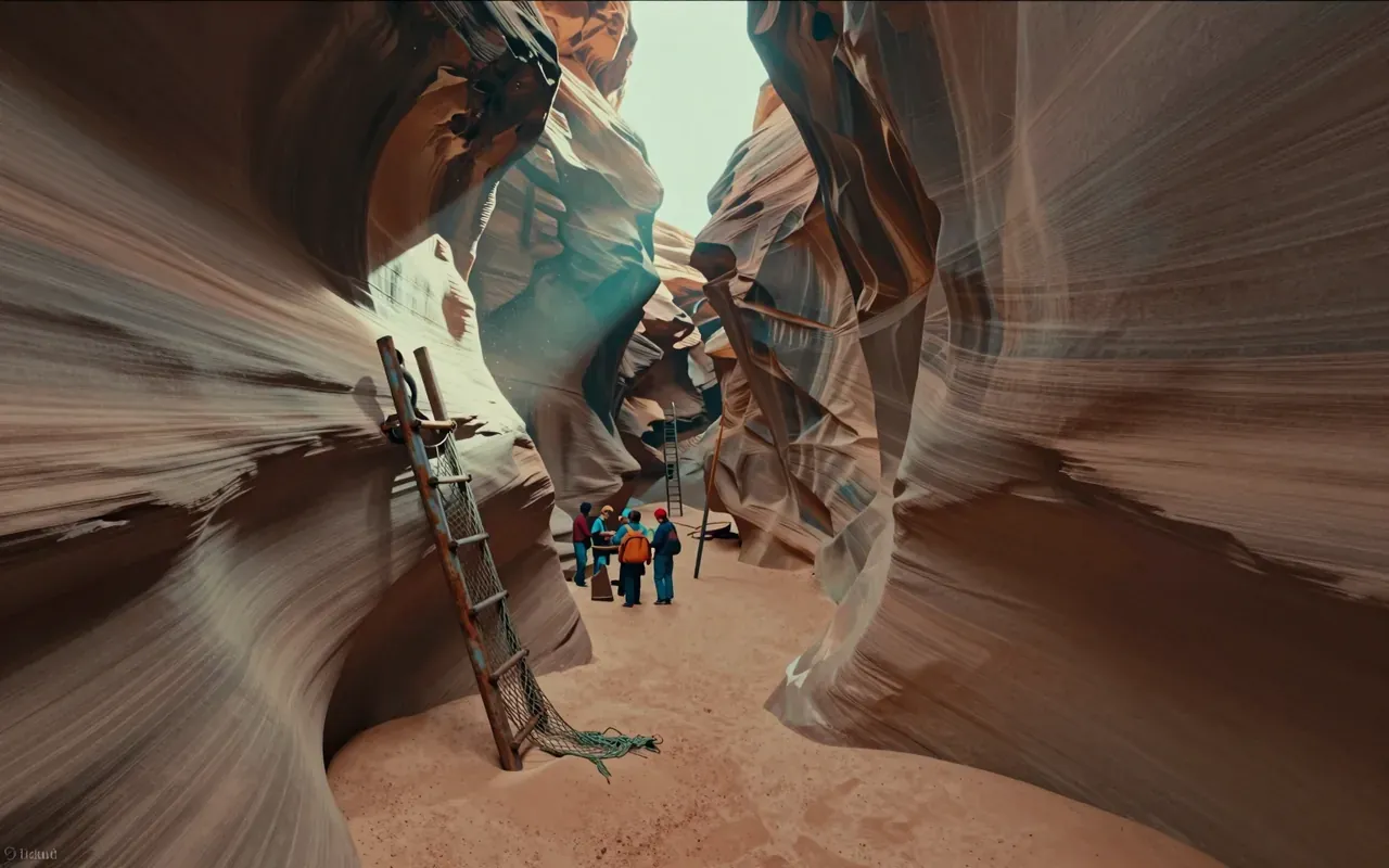
Antelope CanyonAntelope Canyon is a slot canyon on Navajo land in the American Southwest, formed by flash flood erosion of Navajo Sandstone. Monsoon rainwater carries sand into narrow passageways, deepening corridors and smoothing edges into flowing shapes. A flash flood on August 12, 1997 killed eleven tourists in Lower Antelope Canyon — triggered by an upstream thunderstorm 7 miles away. That event replaced amateur wood ladders with bolted systems and cargo nets. Today, a NOAA Weather Radio and alarm horn stand at the fee booth to warn of incoming floods. The canyon remains dangerous, managed, and visually singular.
10:00
TundraThe tundra is a biome defined by frigid temperatures and short growing seasons that inhibit tree growth. It occurs in three regional forms — Arctic, Alpine, and Antarctic. Its vegetation comprises low-growing plants such as dwarf shrubs, sedges, grasses, mosses, and lichens. Soils are nutrient-rich (nitrogen, phosphorus) and store vast amounts of carbon in permafrost, acting as a carbon sink — but warming-induced thaw releases greenhouse gases, creating a climate feedback loop.
9:39
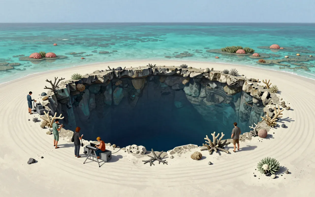
Blue holeBlue holes are marine sinkholes in carbonate bedrock, formed during ice ages when lower sea levels exposed limestone to rain and chemical weathering. They contain tidally influenced but poorly circulated water — fresh, marine or mixed — with sharp haloclines and anoxic deep zones that host bacteria but exclude most marine life. Their high transparency and white carbonate sand produce the signature deep blue colour. They differ from cenotes by holding seawater, not freshwater. They serve as sediment traps preserving climate and fossil records.
8:12
Bryce Canyon National Park1928Bryce Canyon National Park (1928) is a U.S. national park in southwestern Utah. It lies on the Paunsaugunt Plateau within the Colorado Plateau. Its defining features are amphitheater-shaped erosional basins—not canyons—and hoodoos formed by frost weathering and stream erosion of Cenozoic sedimentary rock. Colours derive from hematite (orange), limonite (yellow), and pyrolusite (purple). It experiences a Dsb continental climate. Elevations range from 6,620 to 9,105 feet.
Up next in Nature

Ngorongoro Conservation Area

1959 · 10:14

A conservation area that lets people live with lions—but only on its terms.

10:14